


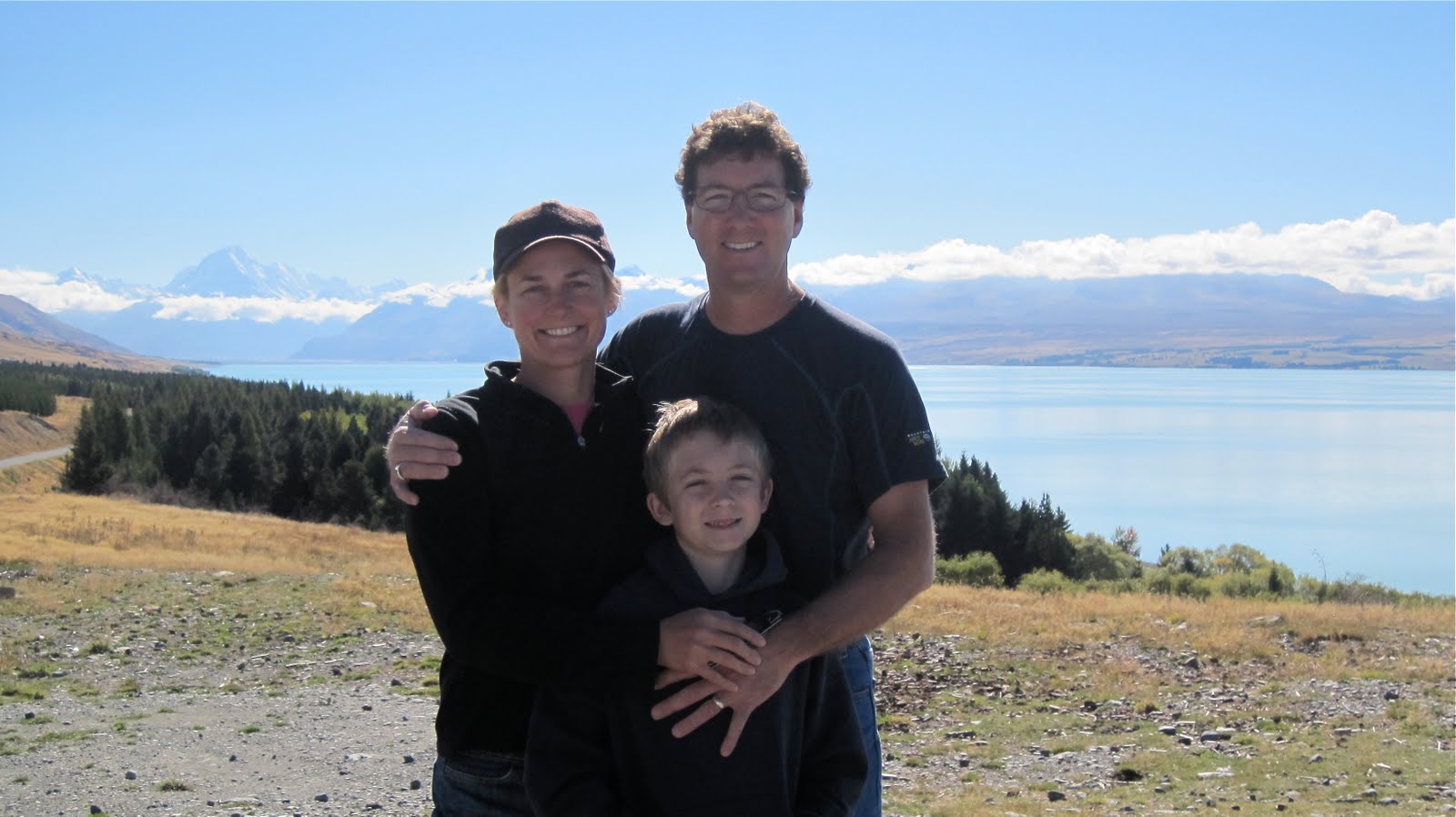


Well, we finally got our sunny day after sitting tight in Twizel for a couple of days. For lovers of the picturesque this was a top-notch day. The alpine scenery was spectacular with Aoraki/Mt. Cook glistening white in all of its glory. As I mentioned before it is the tallest mountain in New Zealand at 3, 754 metres (12,316 feet). Our drive up to the Aoraki/Mt. Cook visitor centre took us along the glacier-fed Lake Pukaki with its sparkling bright turquoise-blue waters. We drove past a musterer with a large mob of sheep and pulled over to watch and listen as the dogs moved the sheep along the rugged mountainside.
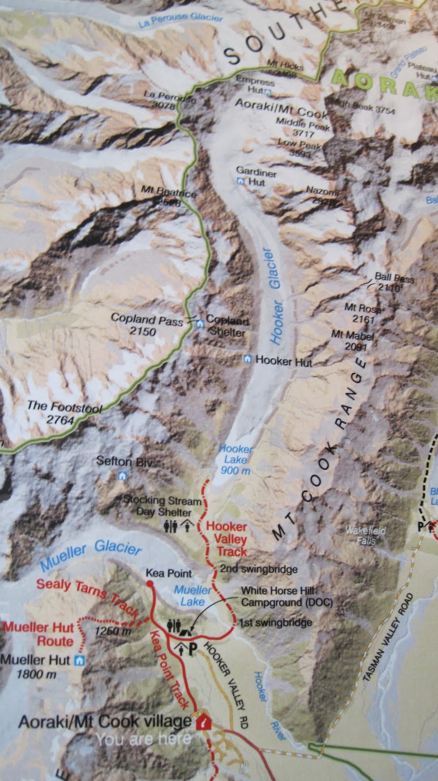
We spent quite a bit of time at the visitors centre learning about glaciers and the history of climbing in this area and watched some videos on the subject. There were exhibits on the rocks and minerals, birds and other wildlife and Gregory also enjoyed the puzzling area where he learned how to remove a small ring looped around bits of chain centered between two horseshoes. Don’t ask me because I haven’t got a clue how he did it! We had a picnic while taking in the sun and the views of Mt. Cook and the Southern Alps. We could also see Tasman Glacier, the largest glacier in New Zealand. At its max speed it recedes at 200m (656 ft.) per year.
We decided we’d like to see the glacier up close and personal so drove the unsealed Tasman Valley Rd. up to the car park and the walk up to the viewing point. We side tracked a bit and walked down to Blue Lakes first. The Blue Lakes were actually more green than blue, but since it was about 4 P.M. and the sun was shining just right I got some beautiful photos of the reflection of the mountains in the water. When we reached the Tasman Glacier viewing point Gregory was at first amazed by the “icebergs” in Tasman Lake. We explained that these were chunks of ice that had broken off of the glacier and though the glacier didn’t look like much, because the ice is covered with about a metre or two of “rock rubble strewn across this hummocky landscape (called surface moraine),” where it meets the head of the lake the glacial ice is 200 metres (656 ft.) thick. Mt. Cook was peaking up to the left adding to the interesting features of this landscape. The other not so interesting thing was the sand flies! I just healed from the last round of bites and now I have more on my neck! My own fault for not putting on my tropical strength repellent but the sun was shining when we left the car park and I wasn’t thinking about sand flies and a chilly dusk.
We had a relaxing drive home, with the sun setting on Lake Pukaki, and stopped to look back at majestic Mt. Cook just one more time before we returned to Twizel. Tomorrow we will drive to Christchurch and Sunday, April 11th it is hello Australia!

No comments:
Post a Comment